Situated between Boyne City and Petoskey, Walloon Lake is just northeast of Lake Charlevoix in Charlevoix and Emmet Counties in Michigan's lower peninsula. This photo was taken east of the lake on an evening in the early fall. In the foreground is Melrose Township Park.
Walled Lake is located near Novi, SW of Pontiac in Oakland County in Michigan's lower peninsula. This aerial photo was taken SE of the lake in the evening during peak fall foliage color, with Pavilion Shore Park in the foreground.
Wall Lake is located near Delton, between Kalamazoo and Hastings in Barry County in Michigan's lower peninsula. This photo was taken north of the lake on a summer day.
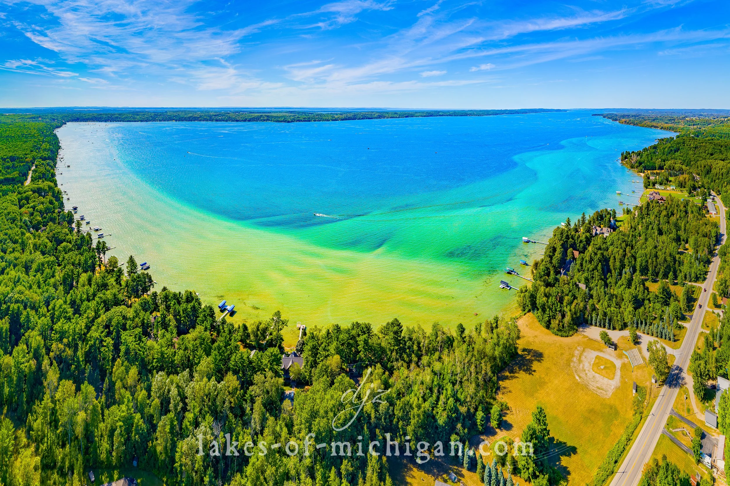
Torch Lake is located near Bellaire, Central Lake, Alden, Rapid City, Eastport, Kewadin, and Rapid City, about 15 miles northeast of Traverse City in Antrim County in Michigan's lower peninsula. This photo was taken at the south end of the 17 mile-long lake on a summer day. The south end of Torch Lake is famous for its shallow sand bar area that is typically packed with boaters and swimmers on sunny summer days. In the lower right corner we can see where the south end of Torch Lake connects to the torch river, which extends 2 miles south to Lake Skegemog.
Torch Lake is located near Bellaire, Central Lake, Alden, Rapid City, Eastport, Kewadin, and Rapid City, about 15 miles NE of Traverse City in Antrim County in Michigan's lower peninsula. This photo was taken SE of the lake on a summer day in 2019.
Torch Lake is located near Bellaire, Central Lake, Alden, Rapid City, Eastport, Kewadin, and Rapid City, about 15 miles northeast of Traverse City in Antrim County in Michigan's lower peninsula. This photo was taken north of the lake on a summer day. On the distant right is Grand Traverse Bay.
The Tippy Dam Pond is located near Wellston about 17 miles east of Manistee in Manistee County in Michigan's lower peninsula. This aerial photo was taken in early fall from the northwest.
Thumb Lake is located about 11 miles ESE of Boyne City and about 11 miles NNW of Gaylord in Charlevoix County Michigan's lower peninsula. This aerial photo was taken on a sunny afternoon in late summer from NE of the lake.
Sylvan Lake is located near Newaygo, south of White Cloud and east of Fremont in Newaygo County in Michigan's lower peninsula. This aerial photo was taken NE of the lake on a summer day. Just beyond Sylvan lake are Emerald, Pickerel, & Kimball Lakes.
Suttons Bay is located on the east side of the Leelanau Peninsula on Grand Traverse Bay, about 16 miles north of Traverse City in Michigan's lower peninsula. This aerial photo was taken from west of the bay on a summer day.
Sturgeon Lake is located in Colon Township about halfway between Three Rivers and Coldwater in St. Joseph County in Michigan's lower peninsula. This aerial photo was taken on a summer day from south of the lake.
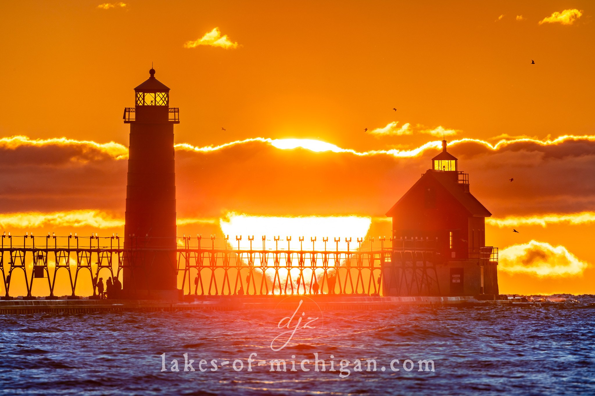
This is an aerial photo taken from the SW showing the St. Joseph shoreline with Silver Beach, the Piers & Lighthouses, the St. Joseph River, and part of the city in Berrien County.
Spider Lake is located about 8 miles southeast of Traverse City in Grand Traverse County in Michigan's lower peninsula. This aerial photo was taken from north of the lake on a summer morning.
Sleeping Bear Bay is nestled by Sleeping Bear Dunes National Lakeshore near Glen Arbor, along the shores of Leelanau County on Lake Michigan in Michigan's lower peninsula. This aerial photo was taken from Glen Arbor in the Summer facing north.
Sleeping Bear Bay is nestled by Sleeping Bear Dunes National Lakeshore near Glen Arbor, along the shores of Leelanau County on Lake Michigan in Michigan's lower peninsula. Its turquoise blue waters look like something in the tropics. This aerial photo was taken from Glen Arbor in the Summer, facing NNW towards North Manitou Island and South Manitou Island. The point on the left is Sleeping Bear Point.
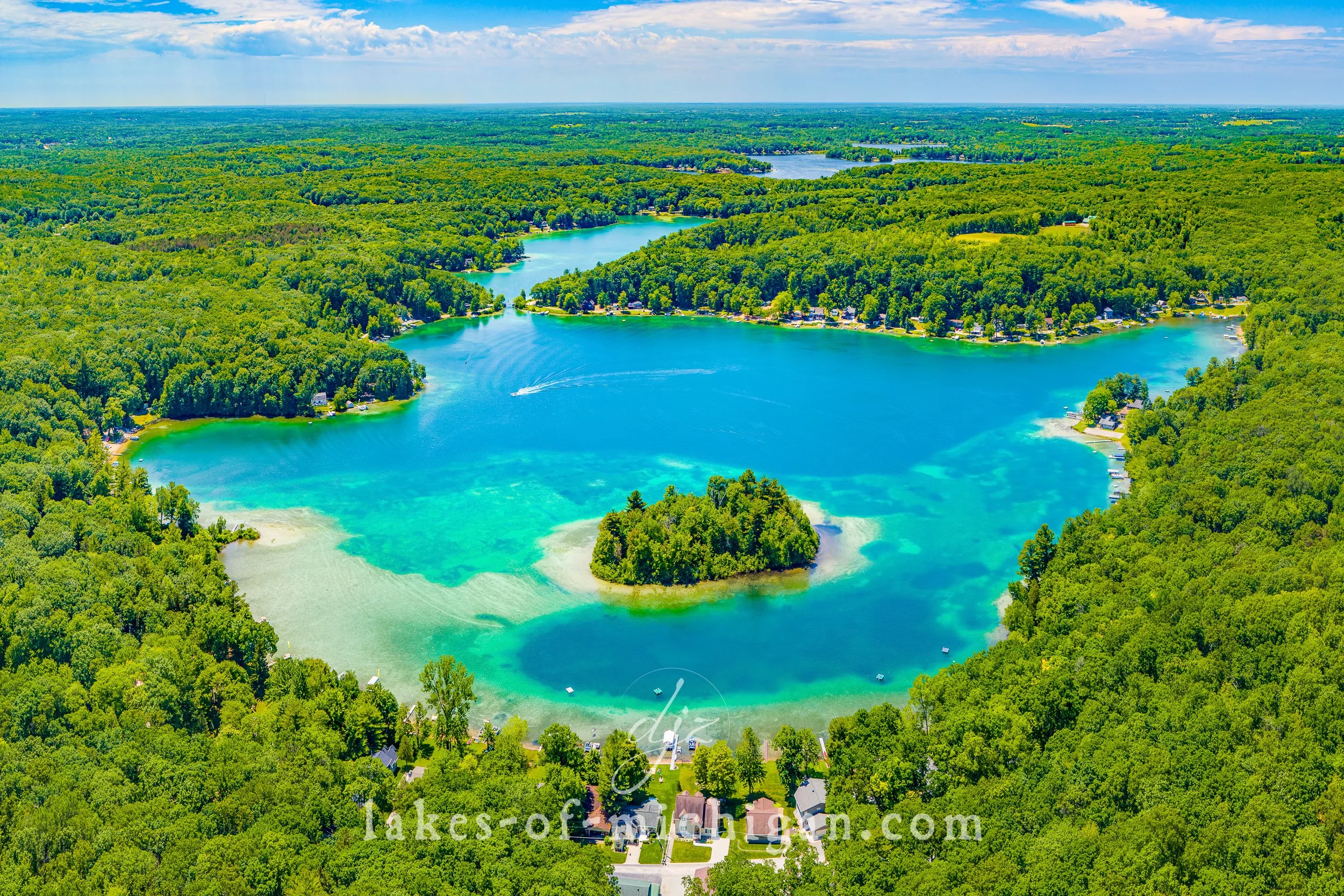
Silver Lake is located a few miles southwest of Traverse City in Grand Traverse County in Michigan's lower peninsula. This aerial photo was taken on a summer morning from north of the lake.
Located between Rockford and Cannonsburg, Silver Lake is about 12 miles northeast of Grand Rapids in Kent County in Michigan's lower peninsula. This photo was taken north of the lake on a summer day.
Located near U.S. Highway 131 between Big Rapids and Stanwood in Mecosta County, Rogers Dam is owned and operated by Consumers Energy. This aerial photo was taken from SW of the dam on a summer day.
Reeds Lake is located in East Grand Rapids, about 3 miles east of downtown Grand Rapids in Michigan's lower peninsula. This aerial photo was taken SE of the lake on a summer morning. In the distance we can see the buildings of downtown Grand Rapids.