
Landscape Photography

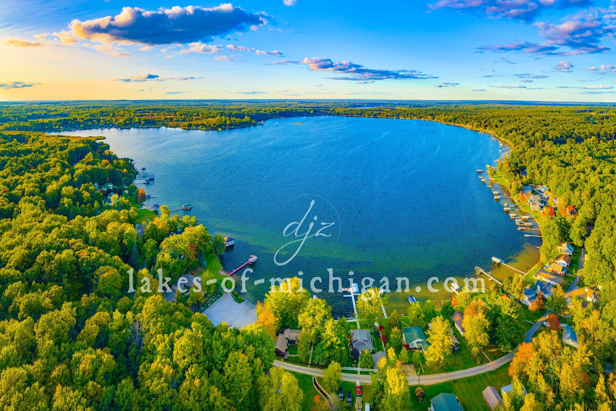
Whitmore Lake near Ann Arbor Aerial Photo from SW in 2019
Whitmore Lake is situated between Brighton and Ann Arbor in Livingston and Washtenaw Counties in Michigan's lower peninsula. This aerial photo was taken southwest of the lake in the morning during peak fall foliage color.

Whitmore Lake is situated between Brighton and Ann Arbor in Livingston and Washtenaw Counties in Michigan's lower peninsula. This aerial photo was taken southwest of the lake in the morning during peak fall foliage color.
Prints are available to purchase by clicking the image above or by visiting lakes-of-michigan.com.
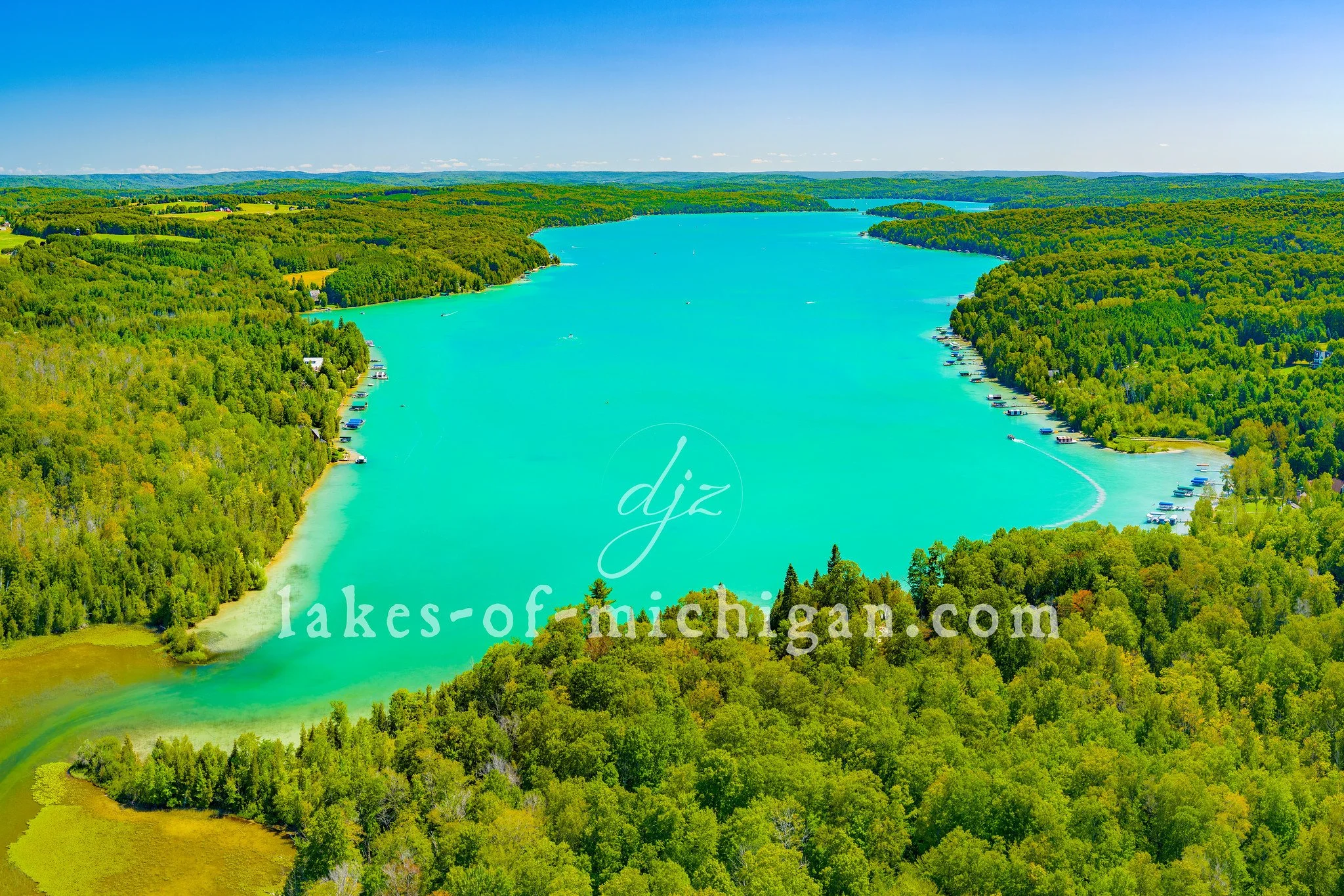
Whitefish Lake near Cedar Springs Aerial Photo from South
Whitefish Lake is located about 7 miles north of Cedar Springs, and 25 miles north of Grand Rapids in Montcalm County in Michigan's lower peninsula. This aerial photo was taken from south of the lake on a late summer evening.

Whitefish Lake is located about 7 miles north of Cedar Springs, and 25 miles north of Grand Rapids in Montcalm County in Michigan's lower peninsula. This aerial photo was taken from south of the lake on a late summer evening.
Prints are available to purchase by clicking the image above or by visiting lakes-of-michigan.com.

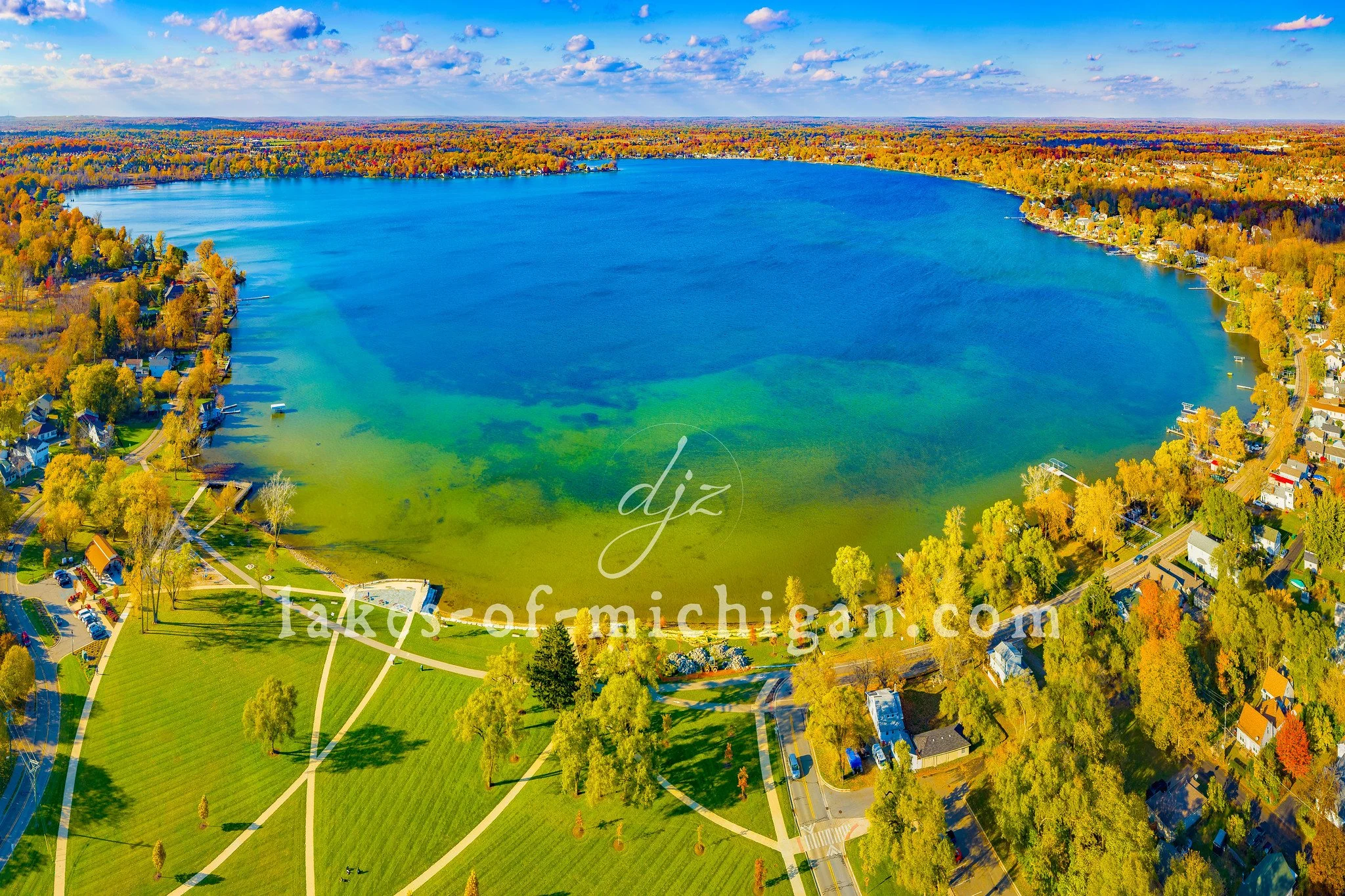
White Lake near Whitehall Aerial Photo from SW in 2019
White Lake is situated between Whitehall and Wabaningo, about 10 miles north of Muskegon on the western shores of Muskegon County in Michigan's lower peninsula. This photo was taken southwest of the lake on a summer day.

White Lake is situated between Whitehall and Wabaningo, about 10 miles north of Muskegon on the western shores of Muskegon County in Michigan's lower peninsula. This photo was taken southwest of the lake on a summer day.
Prints are available to purchase by clicking the image above or by visiting lakes-of-michigan.com.

Grand Haven Lighthouses at Sunset 2x1 Pano in 2020
This is a panoramic photo of the Grand Haven Lighthouses after sunset with some beautiful wave-like clouds rolling through.

This is a panoramic photo of the Grand Haven Lighthouses after sunset with some beautiful wave-like clouds rolling through.
Prints are available to purchase by clicking the image above or by visiting lakes-of-michigan.com.
Walloon Lake near Petoskey Aerial Photo from NW
Situated between Boyne City and Petoskey, Walloon Lake is just northeast of Lake Charlevoix in Charlevoix and Emmet Counties in Michigan's lower peninsula. This aerial photo was taken from the northwest end of the lake on a summer day.

Situated between Boyne City and Petoskey, Walloon Lake is just northeast of Lake Charlevoix in Charlevoix and Emmet Counties in Michigan's lower peninsula. This aerial photo was taken from the northwest end of the lake on a summer day.
Prints are available to purchase by clicking the image above or by visiting lakes-of-michigan.com.

Walloon Lake near Petoskey Aerial Photo from East in Early Fall
Situated between Boyne City and Petoskey, Walloon Lake is just northeast of Lake Charlevoix in Charlevoix and Emmet Counties in Michigan's lower peninsula. This photo was taken east of the lake on an evening in the early fall. In the foreground is Melrose Township Park.

Situated between Boyne City and Petoskey, Walloon Lake is just northeast of Lake Charlevoix in Charlevoix and Emmet Counties in Michigan's lower peninsula. This photo was taken east of the lake on an evening in the early fall. In the foreground is Melrose Township Park.
Prints are available to purchase by clicking the image above or by visiting lakes-of-michigan.com.
Walled Lake near Novi Aerial Photo from SE
Walled Lake is located near Novi, SW of Pontiac in Oakland County in Michigan's lower peninsula. This aerial photo was taken SE of the lake in the evening during peak fall foliage color, with Pavilion Shore Park in the foreground.

Walled Lake is located near Novi, SW of Pontiac in Oakland County in Michigan's lower peninsula. This aerial photo was taken SE of the lake in the evening during peak fall foliage color, with Pavilion Shore Park in the foreground.
Prints are available to purchase by clicking the image above or by visiting lakes-of-michigan.com.
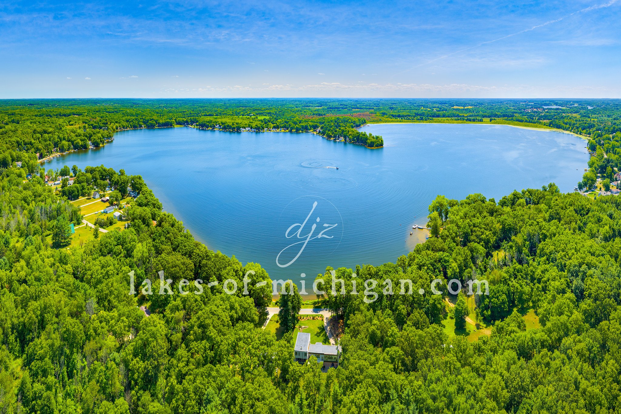
Wall Lake near Delton Aerial Photo from North
Wall Lake is located near Delton, between Kalamazoo and Hastings in Barry County in Michigan's lower peninsula. This photo was taken north of the lake on a summer day.

Wall Lake is located near Delton, between Kalamazoo and Hastings in Barry County in Michigan's lower peninsula. This photo was taken north of the lake on a summer day.
Prints are available to purchase by clicking the image above or by visiting lakes-of-michigan.com.
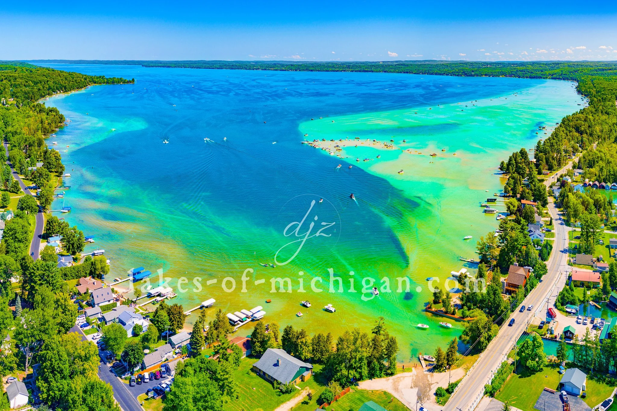
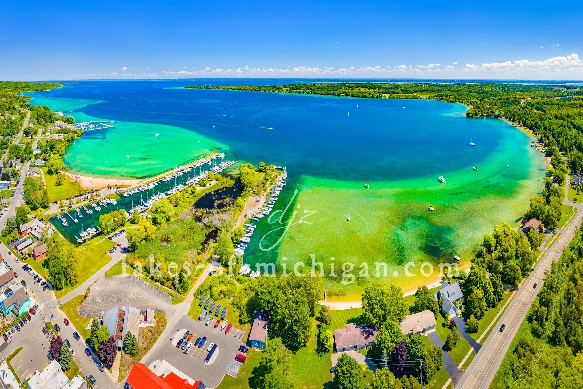
Torch Lake near Bellaire Aerial Photo from South 2020
Torch Lake is located near Bellaire, Central Lake, Alden, Rapid City, Eastport, Kewadin, and Rapid City, about 15 miles northeast of Traverse City in Antrim County in Michigan's lower peninsula. This photo was taken at the south end of the 17 mile-long lake on a summer day. The south end of Torch Lake is famous for its shallow sand bar area that is typically packed with boaters and swimmers on sunny summer days. In the lower right corner we can see where the south end of Torch Lake connects to the torch river, which extends 2 miles south to Lake Skegemog.

Torch Lake is located near Bellaire, Central Lake, Alden, Rapid City, Eastport, Kewadin, and Rapid City, about 15 miles northeast of Traverse City in Antrim County in Michigan's lower peninsula. This photo was taken at the south end of the 17 mile-long lake on a summer day. The south end of Torch Lake is famous for its shallow sand bar area that is typically packed with boaters and swimmers on sunny summer days. In the lower right corner we can see where the south end of Torch Lake connects to the torch river, which extends 2 miles south to Lake Skegemog.
Prints are available to purchase by clicking the image above or by visiting lakes-of-michigan.com.
Torch Lake near Bellaire Aerial Photo from SE 2019
Torch Lake is located near Bellaire, Central Lake, Alden, Rapid City, Eastport, Kewadin, and Rapid City, about 15 miles NE of Traverse City in Antrim County in Michigan's lower peninsula. This photo was taken SE of the lake on a summer day in 2019.

Torch Lake is located near Bellaire, Central Lake, Alden, Rapid City, Eastport, Kewadin, and Rapid City, about 15 miles NE of Traverse City in Antrim County in Michigan's lower peninsula. This photo was taken SE of the lake on a summer day in 2019.
Prints are available to purchase by clicking the image above or by visiting lakes-of-michigan.com.

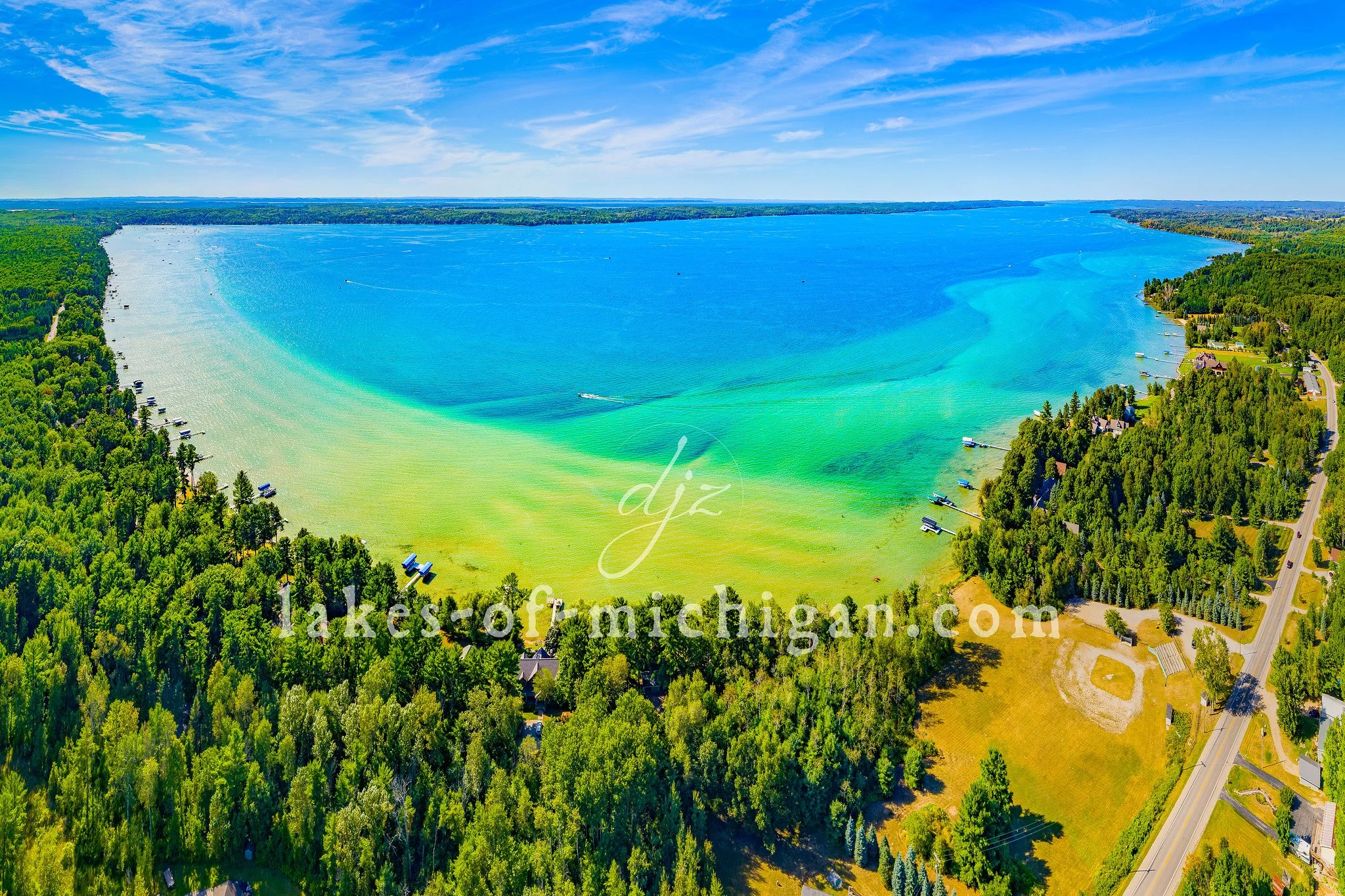
Torch Lake near Bellaire Aerial Photo from North 2019
Torch Lake is located near Bellaire, Central Lake, Alden, Rapid City, Eastport, Kewadin, and Rapid City, about 15 miles northeast of Traverse City in Antrim County in Michigan's lower peninsula. This photo was taken north of the lake on a summer day. On the distant right is Grand Traverse Bay.

Torch Lake is located near Bellaire, Central Lake, Alden, Rapid City, Eastport, Kewadin, and Rapid City, about 15 miles northeast of Traverse City in Antrim County in Michigan's lower peninsula. This photo was taken north of the lake on a summer day. On the distant right is Grand Traverse Bay.
Prints are available to purchase by clicking the image above or by visiting lakes-of-michigan.com.
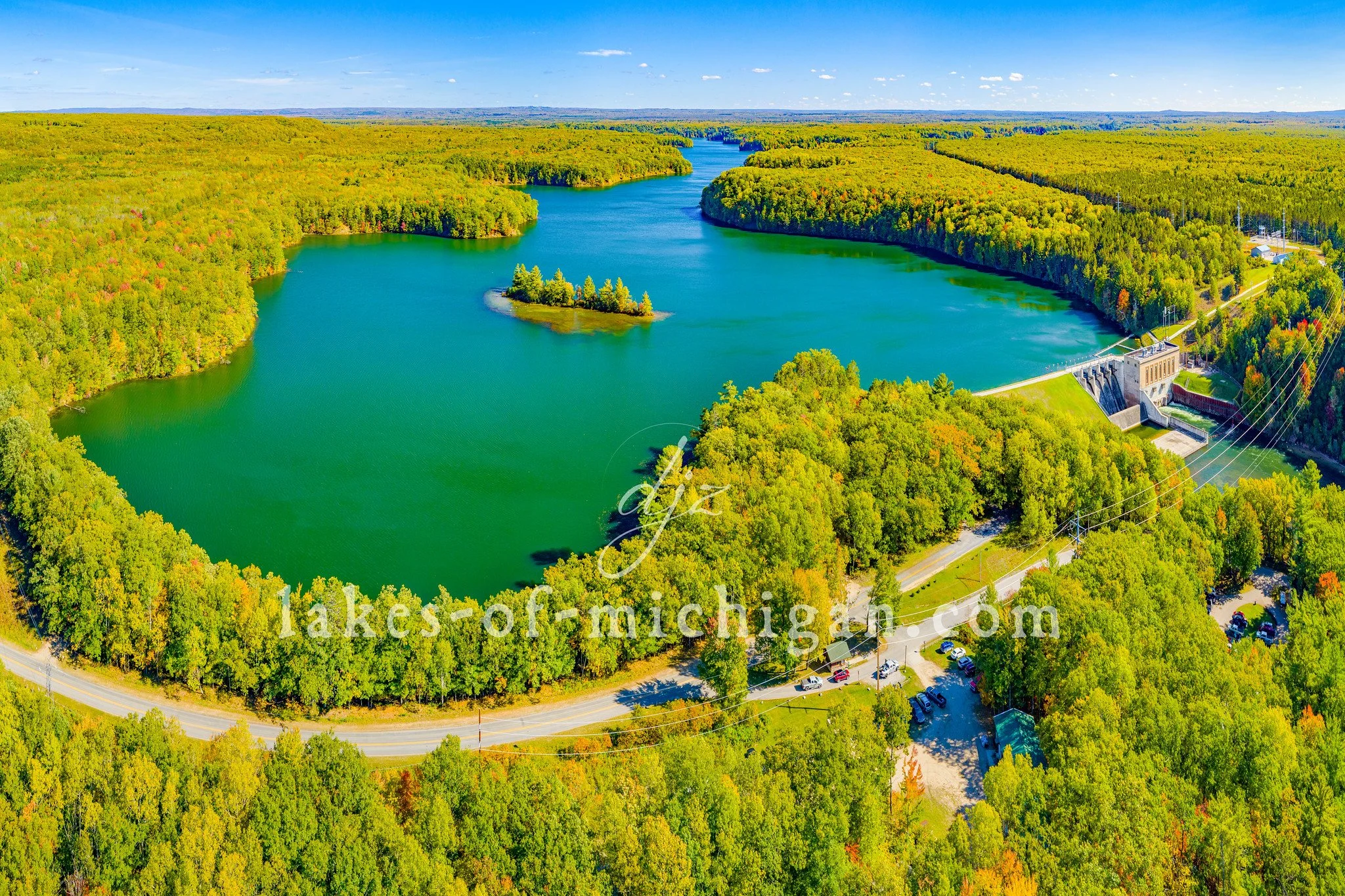
Tippy Dam Pond near Wellston Aerial Photo from NW
The Tippy Dam Pond is located near Wellston about 17 miles east of Manistee in Manistee County in Michigan's lower peninsula. This aerial photo was taken in early fall from the northwest.

The Tippy Dam Pond is located near Wellston about 17 miles east of Manistee in Manistee County in Michigan's lower peninsula. This aerial photo was taken in early fall from the northwest.
Prints are available to purchase by clicking the image above or by visiting lakes-of-michigan.com.
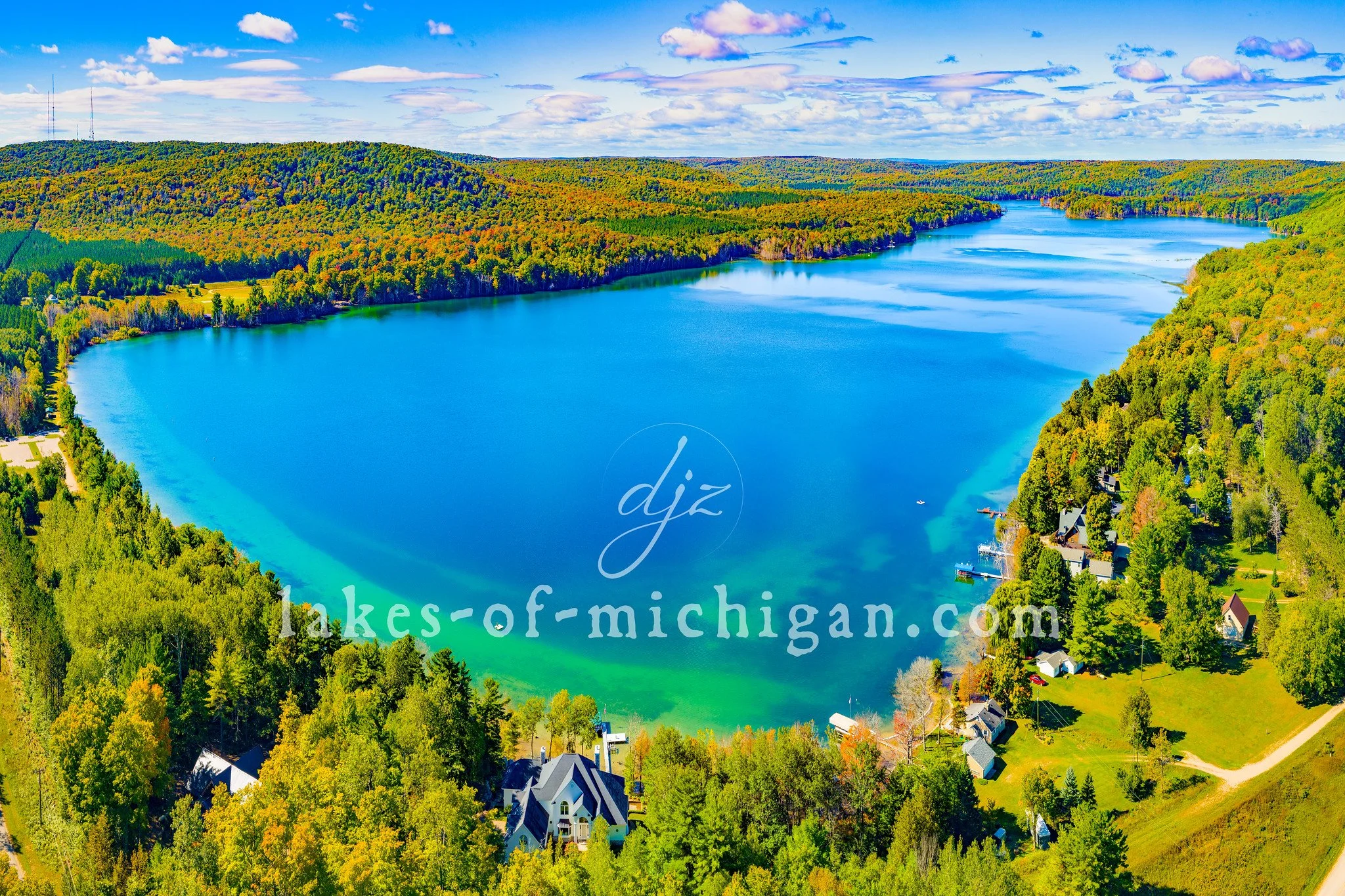
Thumb Lake near Boyne City Aerial Photo from NE
Thumb Lake is located about 11 miles ESE of Boyne City and about 11 miles NNW of Gaylord in Charlevoix County Michigan's lower peninsula. This aerial photo was taken on a sunny afternoon in late summer from NE of the lake.

Thumb Lake is located about 11 miles ESE of Boyne City and about 11 miles NNW of Gaylord in Charlevoix County Michigan's lower peninsula. This aerial photo was taken on a sunny afternoon in late summer from NE of the lake.
Prints are available to purchase by clicking the image above or by visiting lakes-of-michigan.com.

Sylvan Lake near Newaygo Aerial Photo from NE
Sylvan Lake is located near Newaygo, south of White Cloud and east of Fremont in Newaygo County in Michigan's lower peninsula. This aerial photo was taken NE of the lake on a summer day. Just beyond Sylvan lake are Emerald, Pickerel, & Kimball Lakes.

Sylvan Lake is located near Newaygo, south of White Cloud and east of Fremont in Newaygo County in Michigan's lower peninsula. This aerial photo was taken NE of the lake on a summer day. Just beyond Sylvan lake are Emerald, Pickerel, & Kimball Lakes.
Prints are available to purchase by clicking the image above or by visiting lakes-of-michigan.com.
Suttons Bay on the Leelanau Peninsula Aerial Photo from W
Suttons Bay is located on the east side of the Leelanau Peninsula on Grand Traverse Bay, about 16 miles north of Traverse City in Michigan's lower peninsula. This aerial photo was taken from west of the bay on a summer day.

Suttons Bay is located on the east side of the Leelanau Peninsula on Grand Traverse Bay, about 16 miles north of Traverse City in Michigan's lower peninsula. This aerial photo was taken from west of the bay on a summer day.
Prints are available to purchase by clicking the image above or by visiting lakes-of-michigan.com.
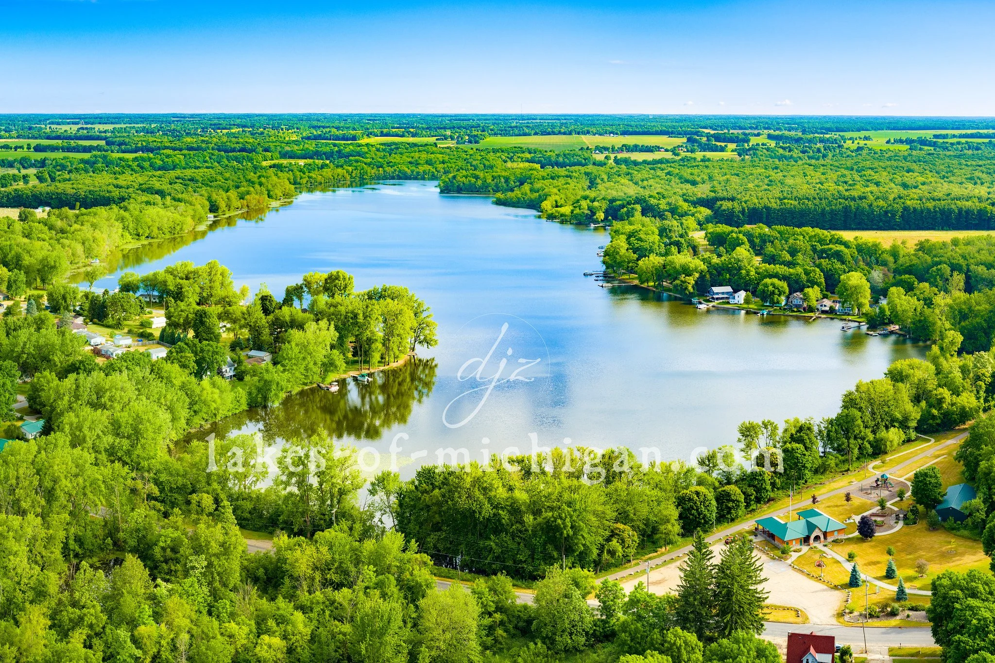
Sturgeon Lake near Colon Township Aerial Photo from South
Sturgeon Lake is located in Colon Township about halfway between Three Rivers and Coldwater in St. Joseph County in Michigan's lower peninsula. This aerial photo was taken on a summer day from south of the lake.

Sturgeon Lake is located in Colon Township about halfway between Three Rivers and Coldwater in St. Joseph County in Michigan's lower peninsula. This aerial photo was taken on a summer day from south of the lake.
Prints are available to purchase by clicking the image above or by visiting lakes-of-michigan.com.

St. Joseph North Pier Lighthouse at Sunset 2020
This is a photo of the St. Joseph North Pier Inner & Outer Lighthouses at Sunset. I wasn't sure if the clouds were going to block the sun as I was driving there, but the clouds turned out to add beautiful color bands to the photo.

This is a photo of the St. Joseph North Pier Inner & Outer Lighthouses at Sunset. I wasn't sure if the clouds were going to block the sun as I was driving there, but the clouds turned out to add beautiful color bands to the photo.
Prints are available to purchase by clicking the image above or by visiting lakes-of-michigan.com.

St Joseph Shoreline with Silver Beach and Piers from SW
This is an aerial photo taken from the SW showing the St. Joseph shoreline with Silver Beach, the Piers & Lighthouses, the St. Joseph River, and part of the city in Berrien County.

This is an aerial photo taken from the SW showing the St. Joseph shoreline with Silver Beach, the Piers & Lighthouses, the St. Joseph River, and part of the city in Berrien County.
Prints are available to purchase by clicking the image above or by visiting lakes-of-michigan.com.

St Joseph North Pier Lights with Crescent Moon and Venus 2021
This photo of the St. Joseph North Pier lights was taken on May 12th, 2021 as the 1.5% crescent moon chased Venus through the sky above.

This photo of the St. Joseph North Pier lights was taken on May 12th, 2021 as the 1.5% crescent moon chased Venus through the sky above.
Prints are available to purchase by clicking the image above or by visiting lakes-of-michigan.com.

St Joseph North Pier Lighthouses at Sunset Spring 2021
This is a photo of the St. Joseph North Pier Lighthouses just before sunset in May of 2021.

This is a photo of the St. Joseph North Pier Lighthouses just before sunset in May of 2021.
Prints are available to purchase by clicking the image above or by visiting lakes-of-michigan.com.