Aerial Photographer - Based in West Michigan
Dan, the owner and photographer of DJZ Photography, is an FAA certified remote pilot with a small UAS (unmanned aircraft systems) rating.
Contact me for new aerial photo & video projects.
To see more of my aerial work along with Michigan lakes & lighthouses, see my other website, lakes-of-michigan.com.
Aerial Landscape Photos
Kalamazoo Lake is located along the Kalamazoo River between Saugatuck and Douglas in Allegan County in Michigan's lower peninsula. This aerial photo was taken from southeast of the lake on a sunny summer morning.
This aerial photo of the Arcadia Bluffs Golf Club in Manistee County in Michigan's lower peninsula was taken on a summer morning during golden hour from northwest of the golf course.
This aerial photo of Mackinaw Cityfeatures Conkling Heritage Park and the Straits State Harbor marina in the foreground with the Mackinac Bridge and Mackinac Island in the distance.
This aerial photo of the Arcadia Bluffs Golf Club in Manistee County in Michigan's lower peninsula was taken on a summer morning during golden hour from northwest of the golf course.
Kalamazoo Lake is located along the Kalamazoo River between Saugatuck and Douglas in Allegan County in Michigan's lower peninsula. This aerial photo of Saugatuck and Kalamazoo Lake was taken from northwest of the Lake on a summer evening.
Harbor Springs is located across from Petoskey on the north side of Little Traverse Bay in Emmet County in Michigan's lower peninsula. This aerial photo was taken on a hot & humid summer afternoon from west of the harbor.
Crystal Lake is located in the Northwest region of Michigan's lower peninsula in Benzie County near Frankfort, Benzonia and Beulah. This aerial photo was taken southeast of the lake on a summer day, showing a sliver of Lake Michigan in the distance.
This aerial photo of Round Lake and downtown Charlevoix on the northwest shores of Charlevoix County in Michigan's lower peninsula was taken on a summer evening in 2021, featuring Lake Charlevoix in the distance.
Bowers Harbor is located on Old Mission Peninsula on the West Arm of Grand Traverse Bay, about 10 miles North of Traverse City in Grand Traverse County. This aerial photo was taken northeast of the harbor on a summer day in 2021.
This is an aerial photo of the Mission Point Lighthouse near Traverse City taken on a summer day in 2021.
Wamplers Lake is located near Brooklyn about 17 miles southeast of Jackson in Jackson and Lenawee Counties in Michigan's lower peninsula. This aerial photo was taken from southeast of the lake on a fall afternoon during peak fall foliage color.
This aerial photo of Traverse City was taken from northwest of the city over the waters of the West Arm of the Grand Traverse Bay on a sunny afternoon.
Located near Caledonia and Middleville, Duncan Lake is south of Grand Rapids in Barry County in Michigan's lower peninsula. This aerial photo was taken from south of the lake during peak fall foliage color in 2021.
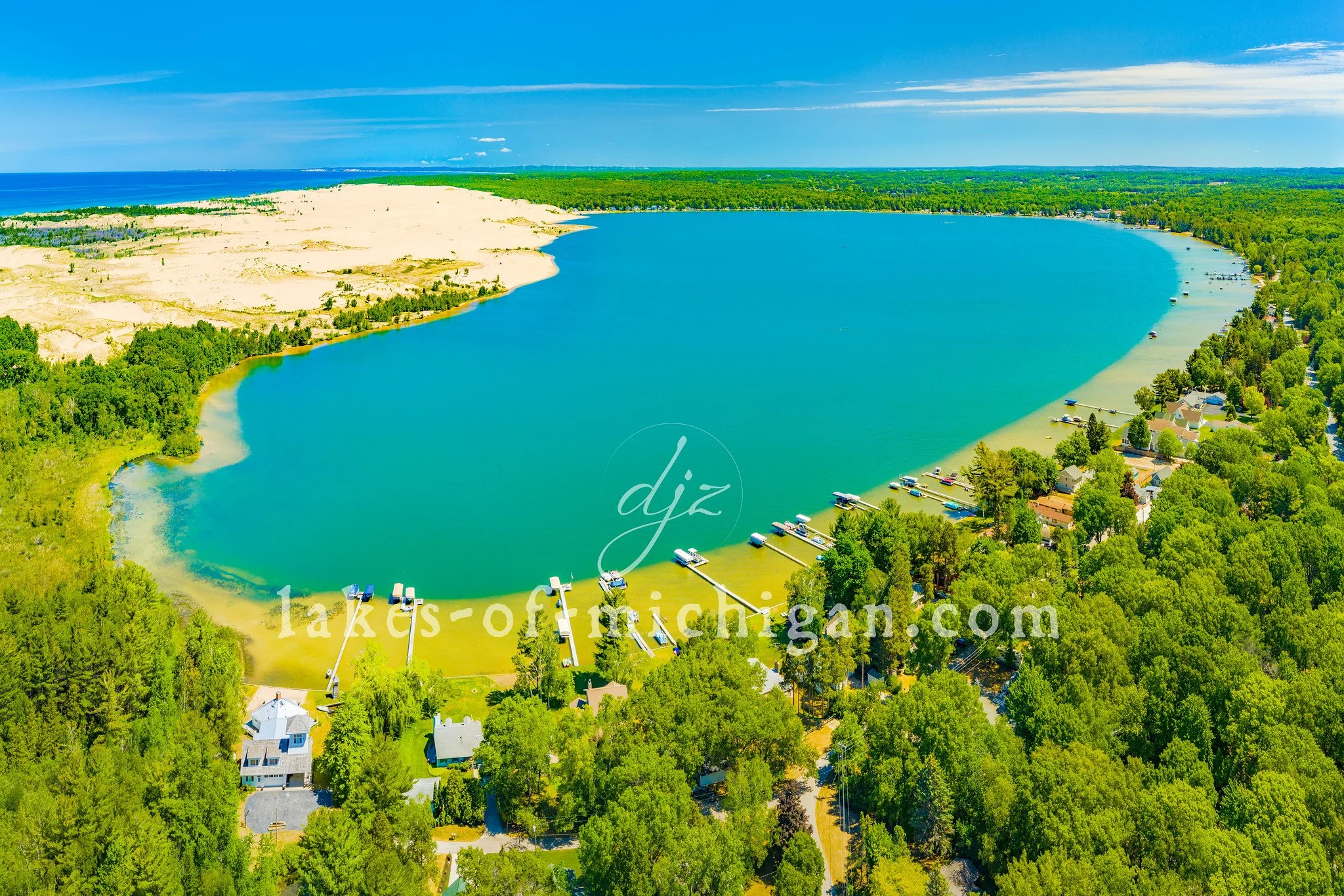
Silver Lake is located near Mears in Oceana County along the western shores of Michigan's lower peninsula. This aerial photo was taken from south of the lake and features the dunes of Silver Lake State Park and Lake Michigan on the left.
Kalamazoo Lake is located along the Kalamazoo River between Saugatuck and Douglas in Allegan County in Michigan's lower peninsula. This aerial photo was taken from southeast of the lake during peak fall foliage colors.
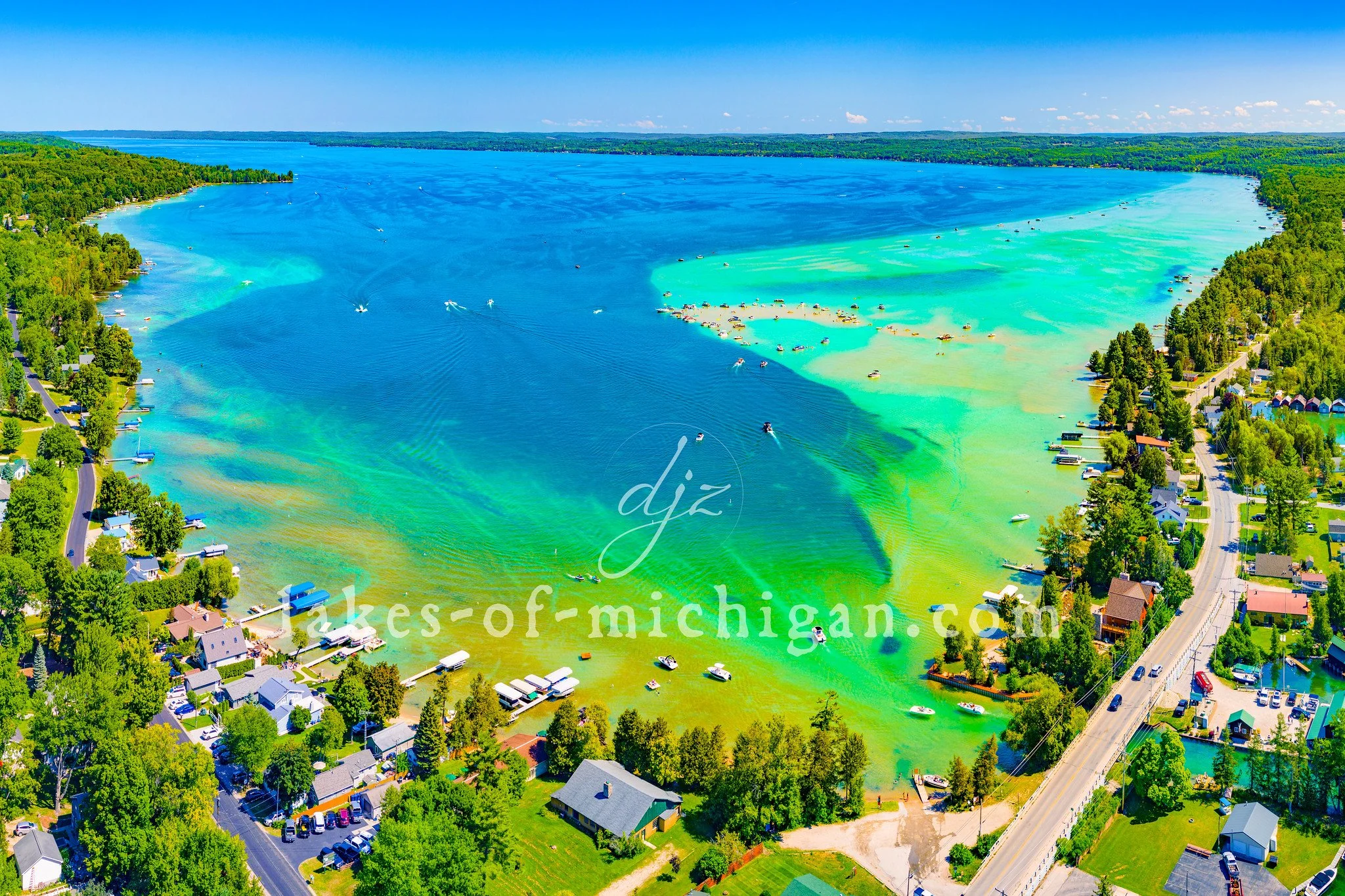
Torch Lake is located near Bellaire, Central Lake, Alden, Rapid City, Eastport, Kewadin, and Rapid City, about 15 miles northeast of Traverse City in Antrim County in Michigan's lower peninsula. This photo was taken at the south end of the 17 mile-long lake on a summer day. The south end of Torch Lake is famous for its shallow sand bar area that is typically packed with boaters and swimmers on sunny summer days. In the lower right corner we can see where the south end of Torch Lake connects to the torch river, which extends 2 miles south to Lake Skegemog.
Torch Lake is located near Bellaire, Central Lake, Alden, Rapid City, Eastport, Kewadin, and Rapid City, about 15 miles northeast of Traverse City in Antrim County in Michigan's lower peninsula. This photo was taken north of the lake on a summer day. On the distant right is Grand Traverse Bay.
Spider Lake is located about 8 miles southeast of Traverse City in Grand Traverse County in Michigan's lower peninsula. This aerial photo was taken from north of the lake on a summer morning.
This aerial photo of the South Haven Piers, Beach, and Lighthouse was taken from west of the lighthouse on a sunny summer afternoon.
Sleeping Bear Bay is nestled by Sleeping Bear Dunes National Lakeshore near Glen Arbor, along the shores of Leelanau County on Lake Michigan in Michigan's lower peninsula. This aerial photo was taken from Glen Arbor in the Summer facing north.
The Round Island Lighthouse is located off the NW tip of Round Island, less than a mile south of Mackinac Island. This aerial photo was taken on a summer morning from south of the lighthouse.
This is an aerial photo of the Point Betsie Lighthouse near Frankfort, taken on a summer afternoon. This lighthouse is located on the shores of Lake Michigan west of Crystal Lake. On the distant left you can see part of Sleeping Bear Dunes.
Pine Lake is located southwest of Pontiac in Oakland County in Michigan's lower peninsula. This aerial photo was taken west of the lake during peak fall foliage color.
Old Mission Harbor is located on the Old Mission Peninsula about 14 miles north of Traverse City within Grand Traverse Bay. This aerial photo was taken on a summer afternoon from north of the harbor facing the East Arm of the Grand Traverse Bay.
The Old Mackinac Point Lighthouse is located in Alexander Henry Park in Mackinaw City at the northern tip of Michigan's lower peninsula. This photo, which also features the Mackinac Bridge, was taken on a summer morning.
This is an aerial photo of the Mission Point Lighthouse at the tip of the Old Mission Peninsula near Traverse City. This panoramic photo features a view of the width peninsula, with the Lighthouse peeking out through the trees on a summer morning.
Mackinac Island is located in the waters of Lake Huron about 6 miles northeast of Mackinaw City and 3 miles east of St. Ignace. This aerial photo was captured on a warm summer morning from south of Biddle Point.
Mackinac Island is located in the waters of Lake Huron about 6 miles northeast of Mackinaw City and 3 miles east of St. Ignace between Michigan's upper and lower peninsulas. This aerial panorama was created on a warm summer morning from south of the island.
This is an aerial photo of the Ludington Piers and North & South Breakwater Lights taken from over Lake Michigan along the shores of Michigan's lower peninsula.
The Little Sable Point Lighthouse stands prominently on the curved shoreline that juts out into the turquoise waters of Lake Michigan near the Silver Lake State Park on the western shores of Michigan's lower peninsula. This aerial photo of the Little Sable Point Lighthouse and beach area was taken in the summer of 2021 from southwest of the lighthouse.
Commercial & Residential Real Estate Aerial Photo Gallery
Real Estate Video Gallery
Aerial video for a real estate MLS Listing